An interactive, label-driven mapping platform for discovering and evaluating US certified-organic farms. Explore 300+ farms — most drawn from the Cornucopia Institute’s dairy and egg scorecards, plus cited hand-curated Amish/family operations — and compose filters across third-party certifications, Cornucopia 1-5 ratings, scope, and self-attested claims, with real-time filtering, geographic search, and multiple view modes.
What It Does
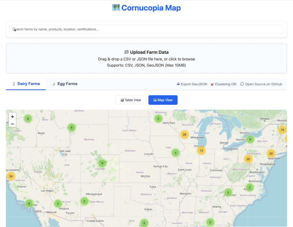
Farm Discovery Made Visual
Search, filter, and explore farms across the country using an interactive map with intelligent clustering. Toggle between Map View and Table View to find exactly what you’re looking for.
Label-Driven Coloring
Each farm carries a stack of labels — certifications, Cornucopia 1-5 ratings, claims, scope, and affiliation. Markers are color-coded by a primary label (rating first, then certification, claim, scope, affiliation): from gold (Cornucopia 5) down to red (1), with certification and scope labels carrying their own colors.
Scopes & Labels
- 🥛 Dairy / 🥚 Eggs — the rated Cornucopia core (the bulk of the dataset)
- Meat · Produce · Retailers — additional scopes now in the data
- Certifications — USDA Organic, Real Organic Project, Demeter (biodynamic), Animal Welfare Approved, Certified Naturally Grown, ROC
- Claims & affiliations — raw dairy, grass-fed, pasture-raised, A2/A2; Amish / family-farm
Key Features
- Real-time filtering by rating, category, and location
- Smart clustering that groups nearby farms at zoom levels
- Detailed farm profiles with contact information, certifications, and products
- GeoJSON export for researchers and analysts
- Custom data upload — bring your own CSV, JSON, or GeoJSON datasets
- Mobile-friendly responsive design for field research
Who It’s For
- Consumers looking for verified, high-quality local farms
- Researchers studying agricultural distribution and sustainability patterns
- Restaurants & retailers sourcing premium ingredients from rated producers
- Policy analysts examining the landscape of quality agriculture in the US
Roadmap
- Farmers markets — adding rated farmers-market listings alongside the existing dairy/egg coverage. Reflected in some site copy ahead of the data landing.